Travels with Lois and Jason
Valley of Marvelous Vistas
(aka Death Valley, California)
and the Valley of Fire, Nevada
February 2 - 8, 2015
Jason wanted to go to Death Valley for many years; Lois was hesitant because of the heat and the fact that we had spent many hours traveling through deserts throughout the southwest and in Israel. A couple of years ago Lois was given a Death Valley National Park book by one of her students with pictures of the spectacular landscapes that piqued her curiosity: could a desert really be that beautiful? We had to go and find out for ourselves.
We selected one of the coolest months of the
year for our visit. The
temperature was in the high 70s and low 80s, but when walking in
full sun in the canyons, to Lois it felt like a 100!
 |
There are areas that looked
like "hot fudge sundaes" with tuff (volcanic ash) on the bottom and alluvial canyon dust on top |
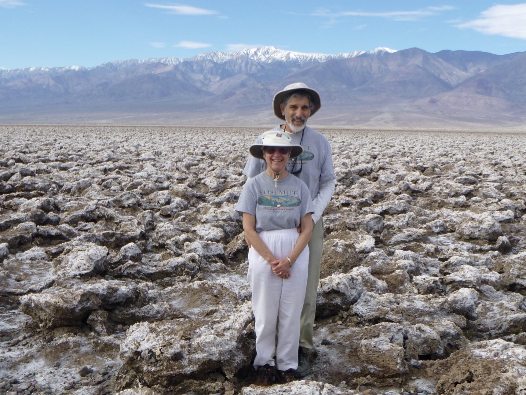
| There is Devils Golf
Course made up of salt deposits |
 |
 |
There are creeks with Pupfish who have
survived from when there was a lake filling the valley 10,000 years ago. The lake was 600 feet deep. |
| There are some areas that
appeared barren, but had little flower buds beginning to open. We were told that in another couple of weeks these areas would be covered with wild flowers. (The white in the background is salt.) |
 |
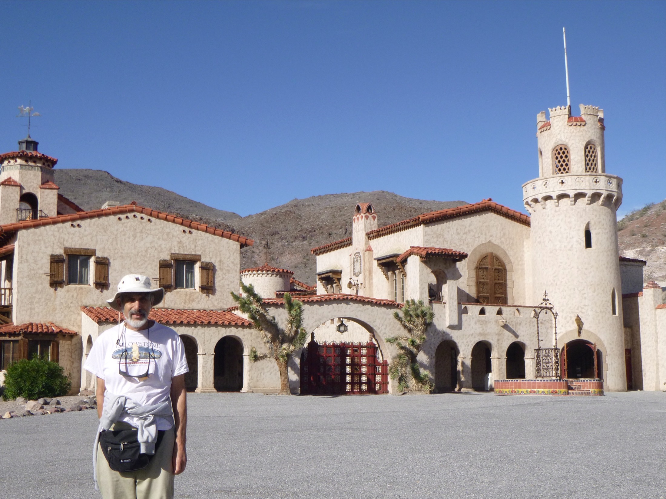 |
There is a castle built by millionaire
Albert Johnson for his wife and named for his friend "Death Valley Scotty," and called Scotty's Castle |
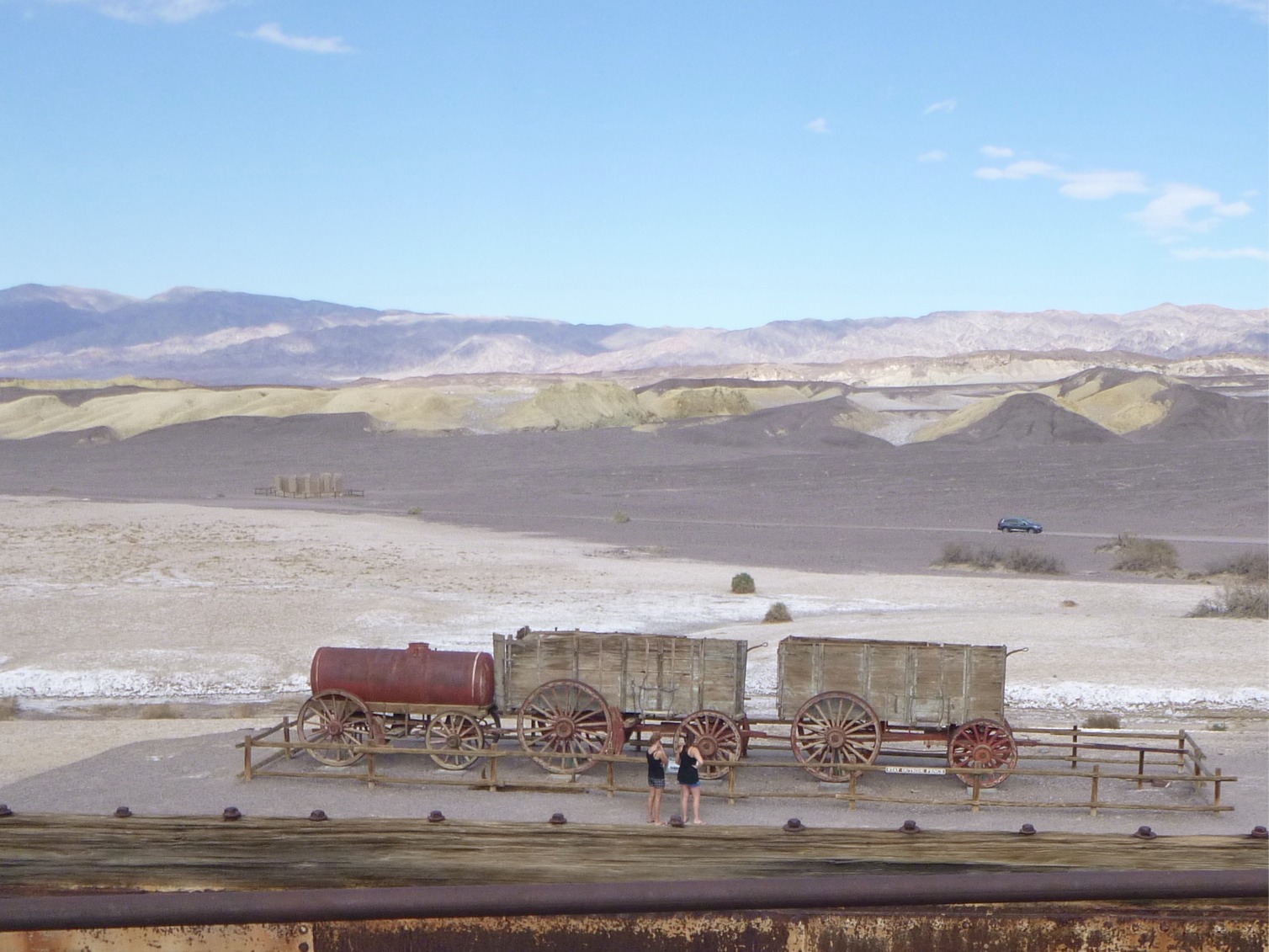
| There are ruins of
an industrial mining plant from which 20 Mule Teams pulled Borax out of the valley |
 |
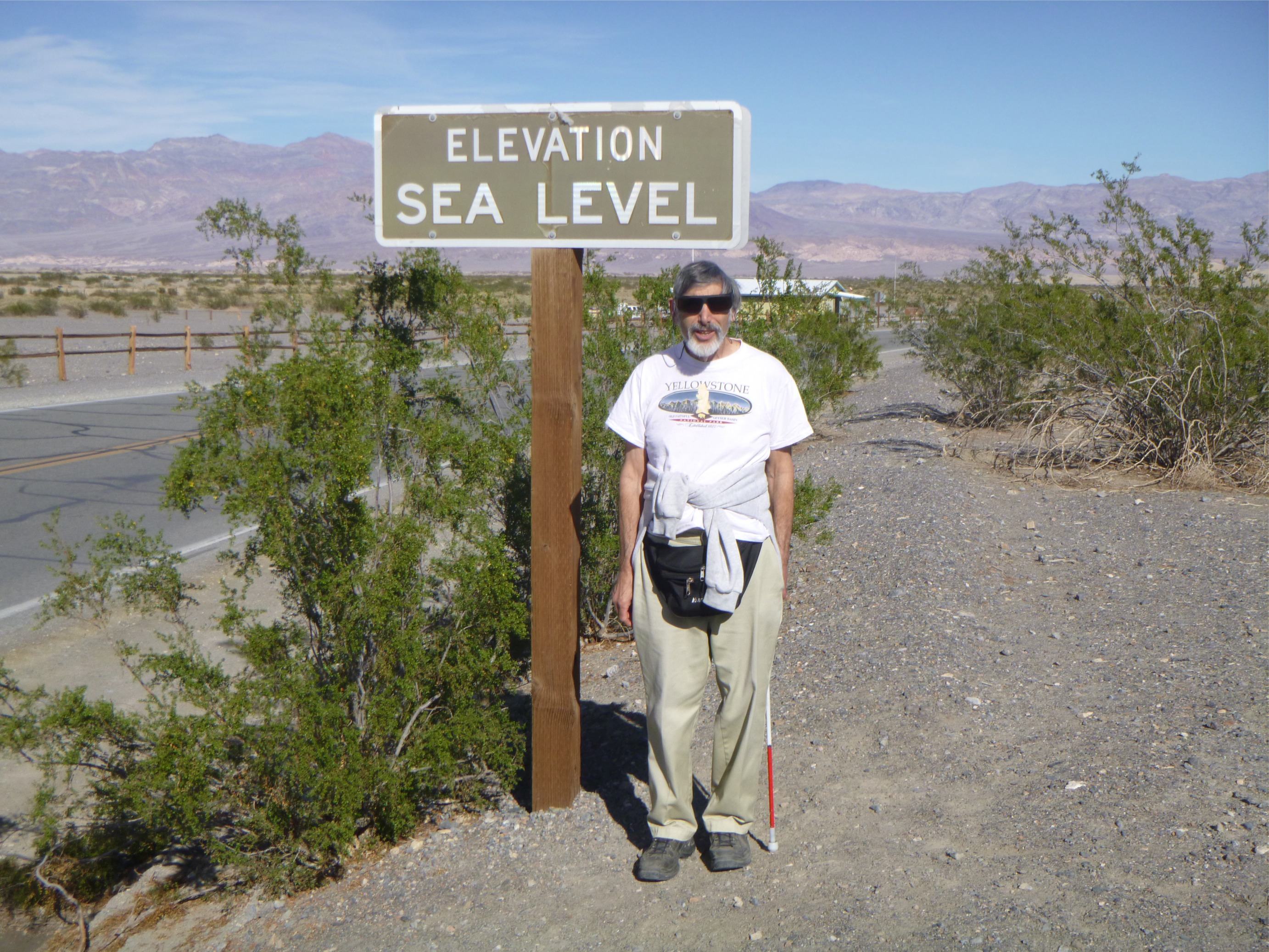 |
There are many signs that read
"Elevation Sea Level" even though we are hundreds of miles from the oceans |
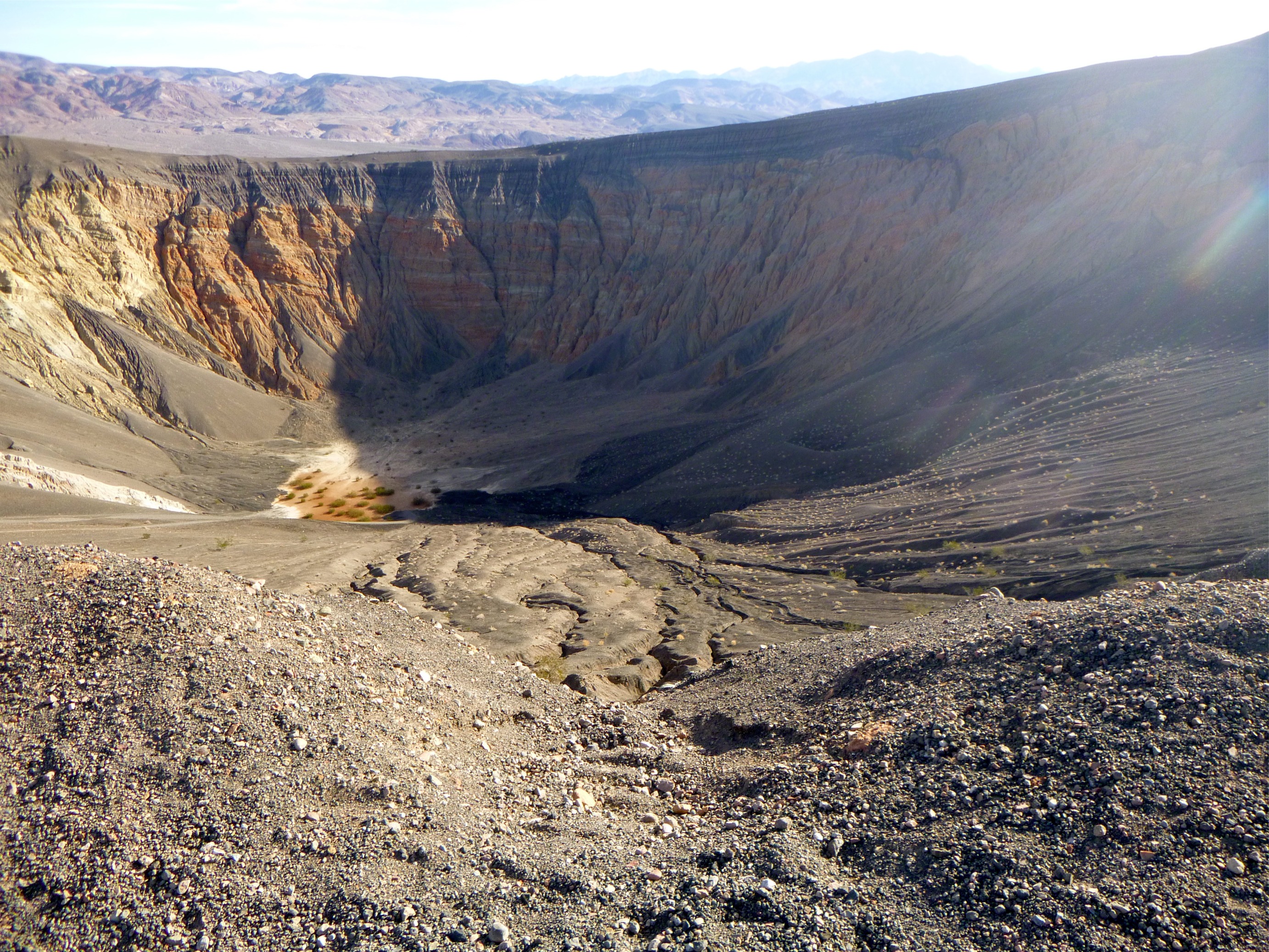
| There is the Ubehebe
volcanic looking crater but not formed by a volcano |
 |
 |
There are areas of pyroclastic flows from the supervolcano in Yellowstone National Park about 1000 miles away |
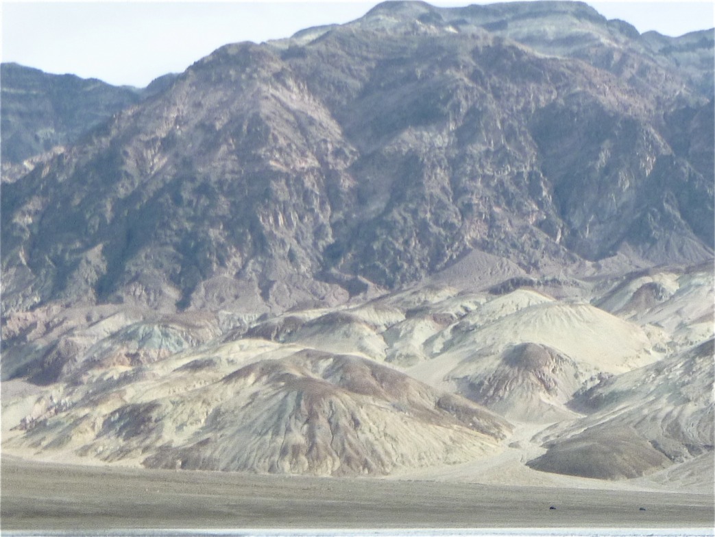
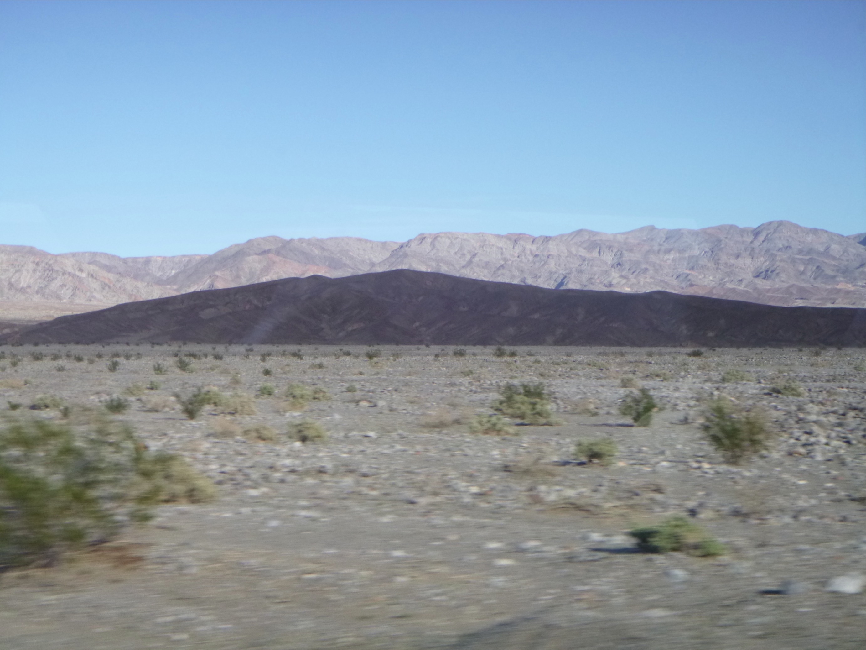
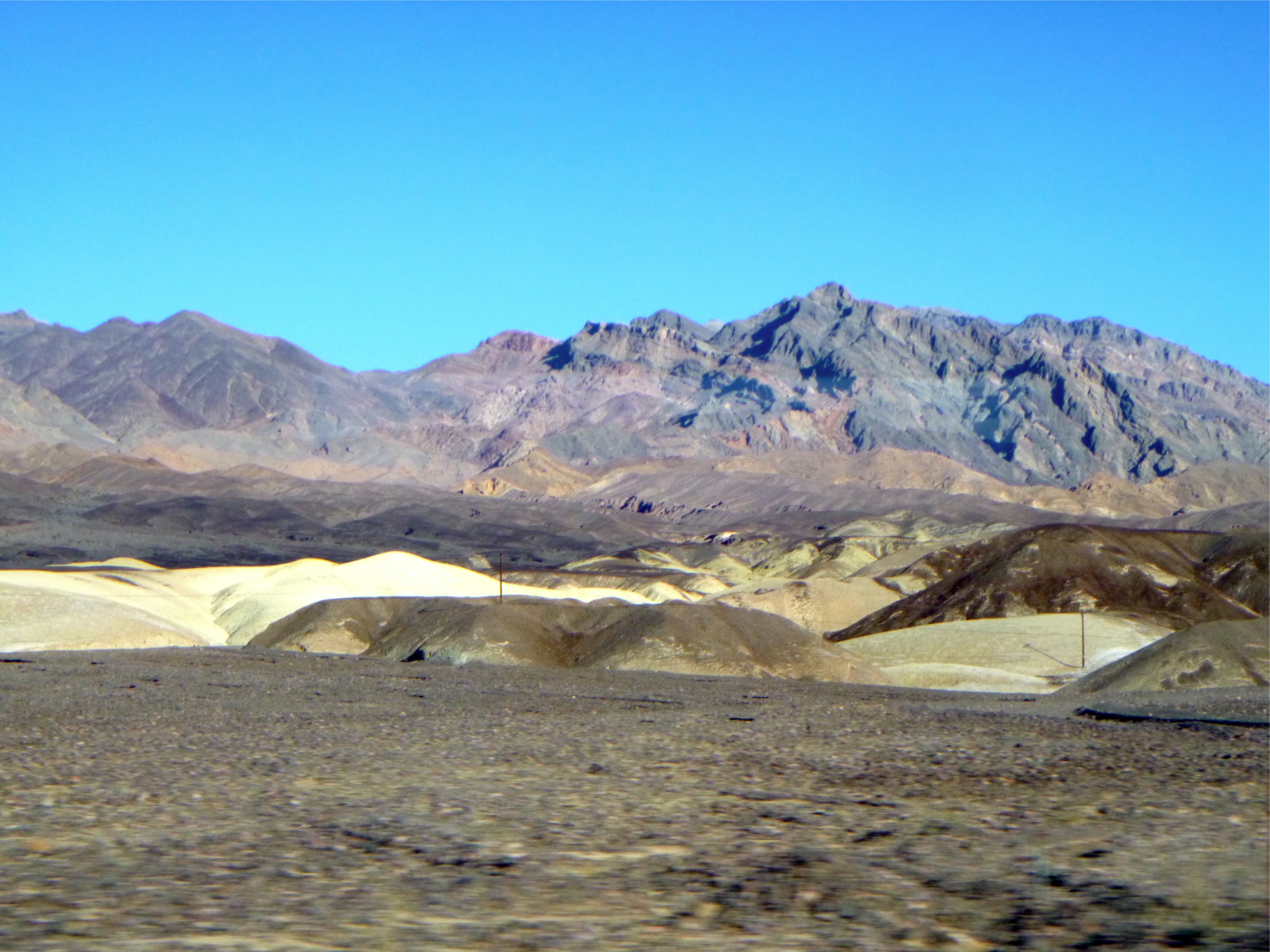
| There are grand colorful
vistas of mountains across the valley |
 |
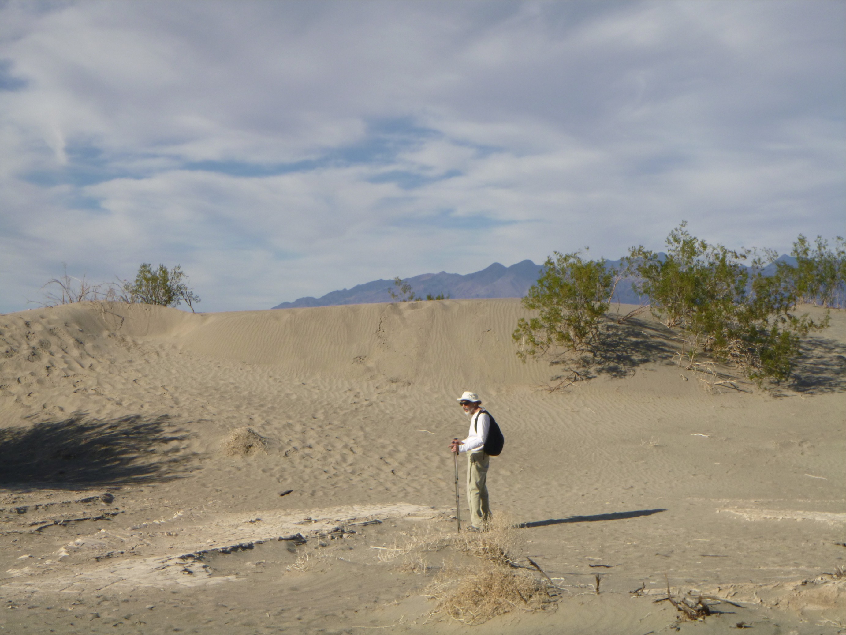 |
And of course, there are sand dunes (after all, it is a desert!) |
In summary, we never imagined that this valley would be so beautiful and the rock formations and colors so exquisite.
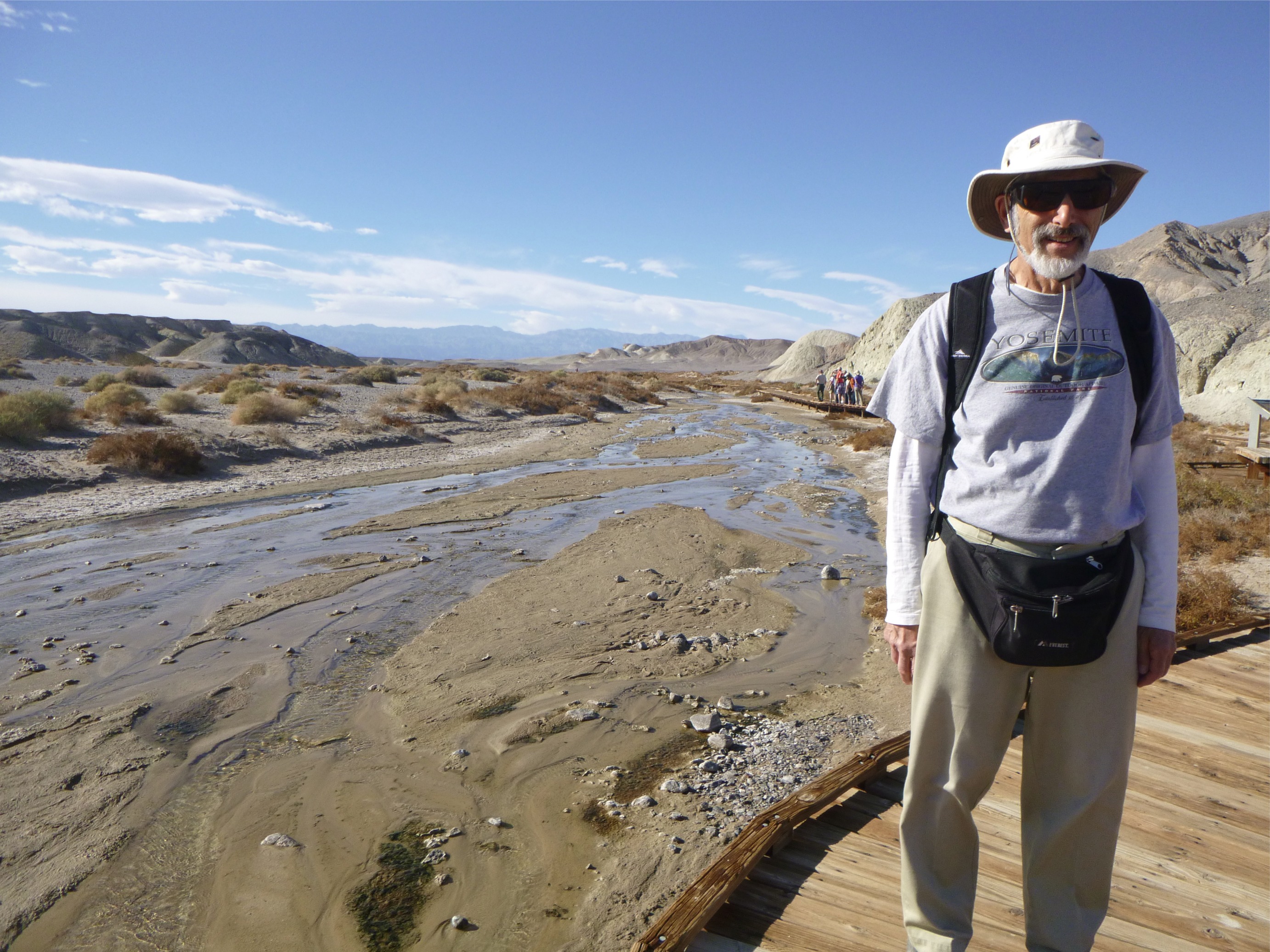
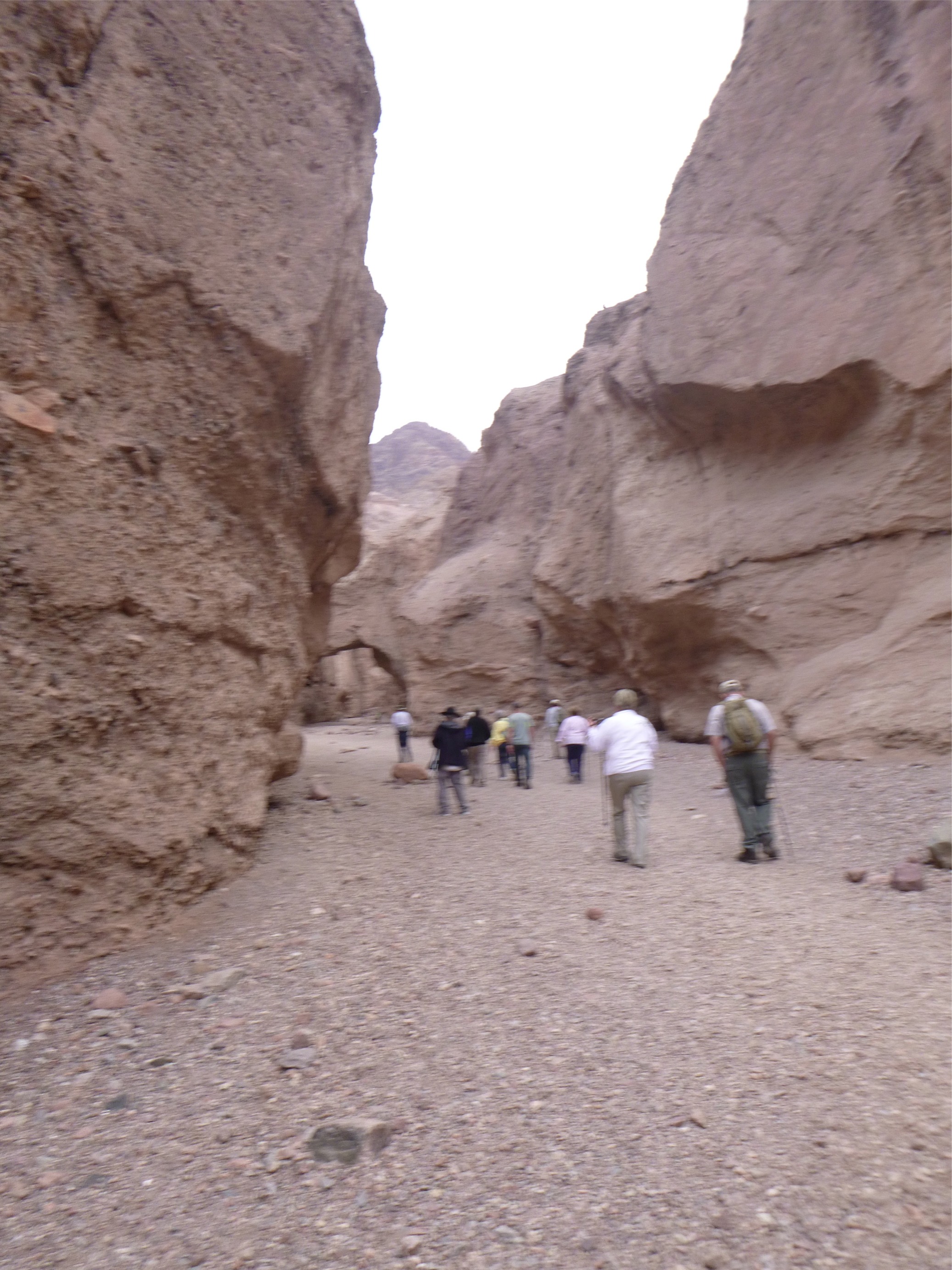
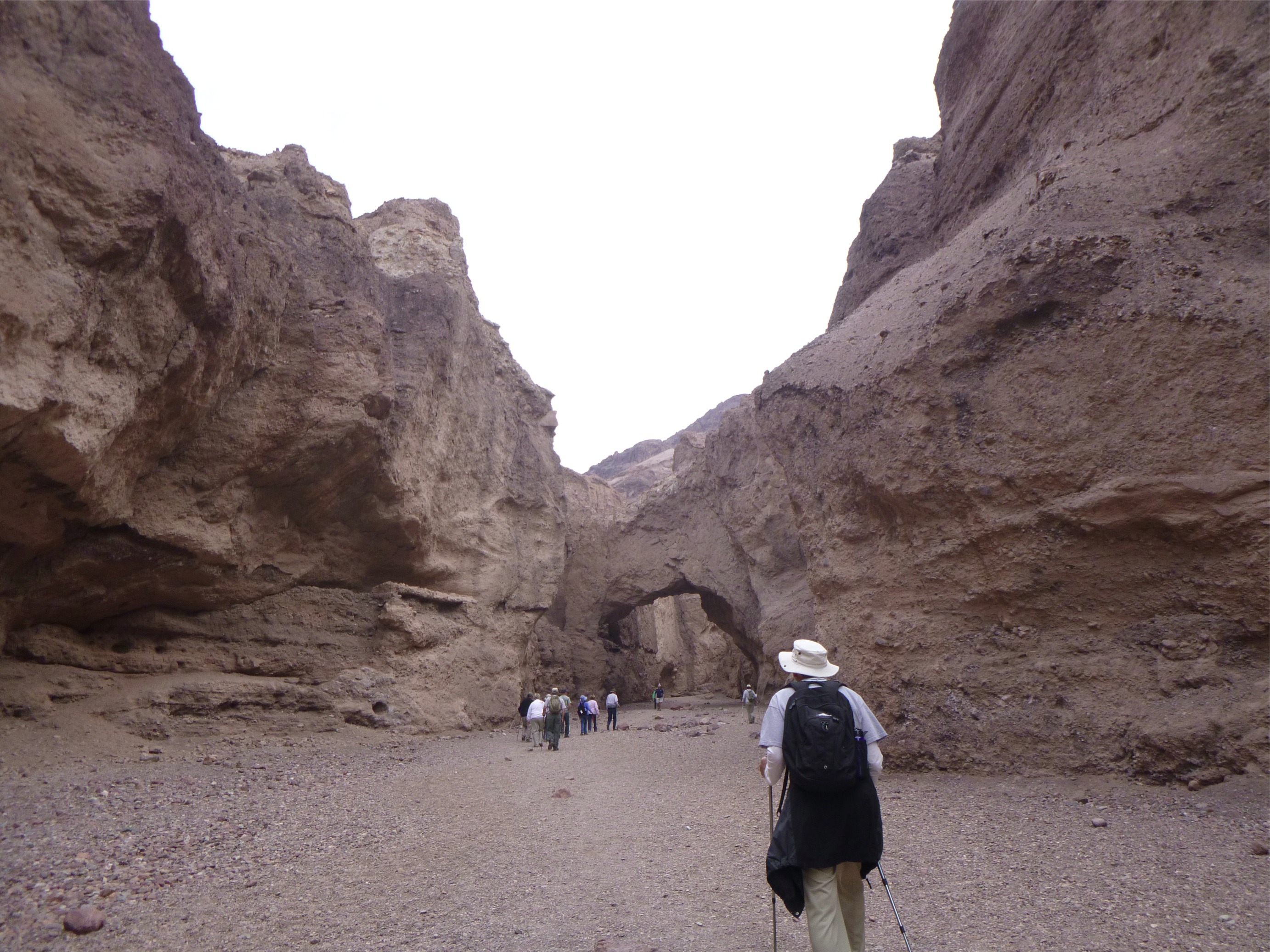
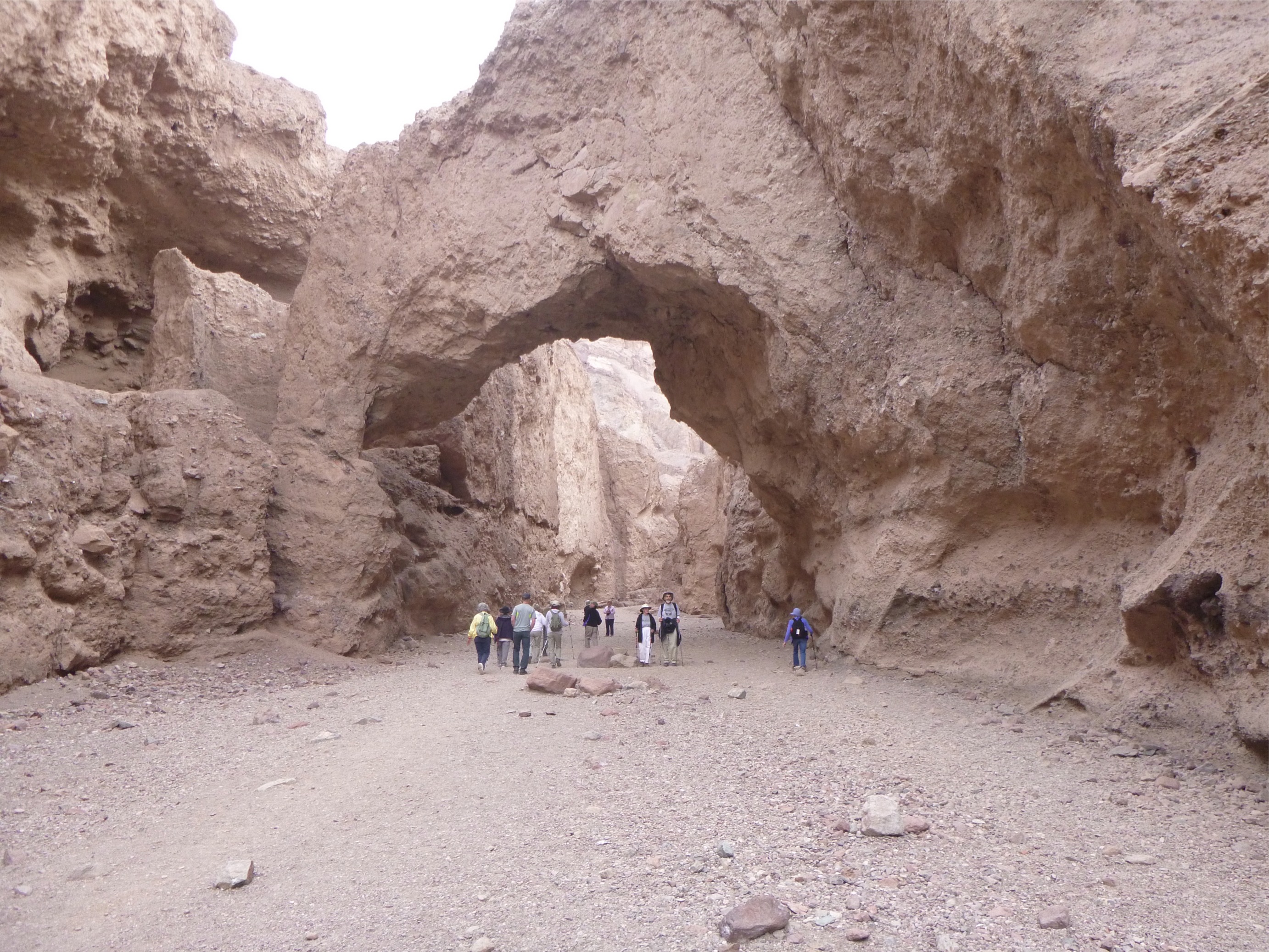
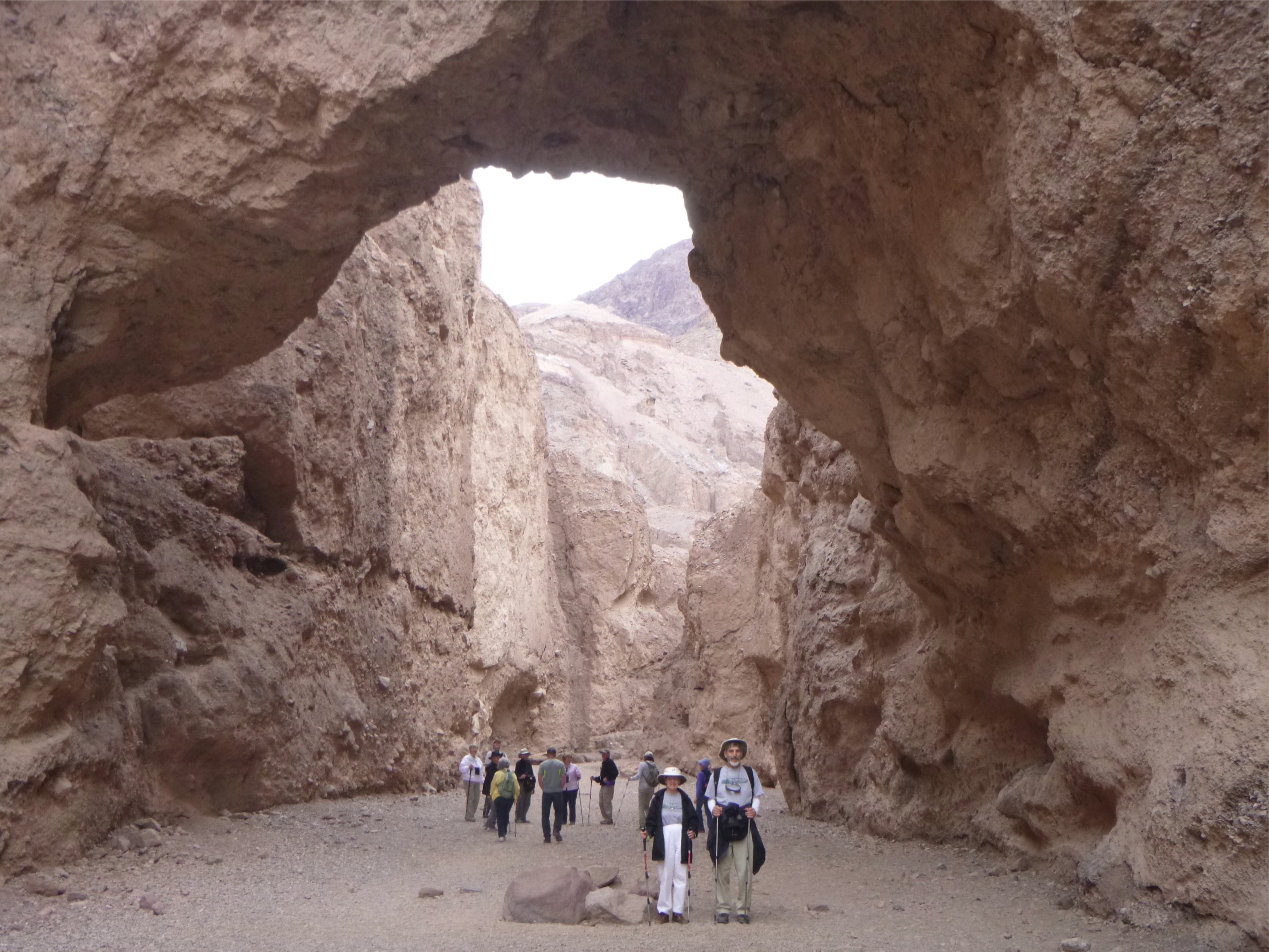
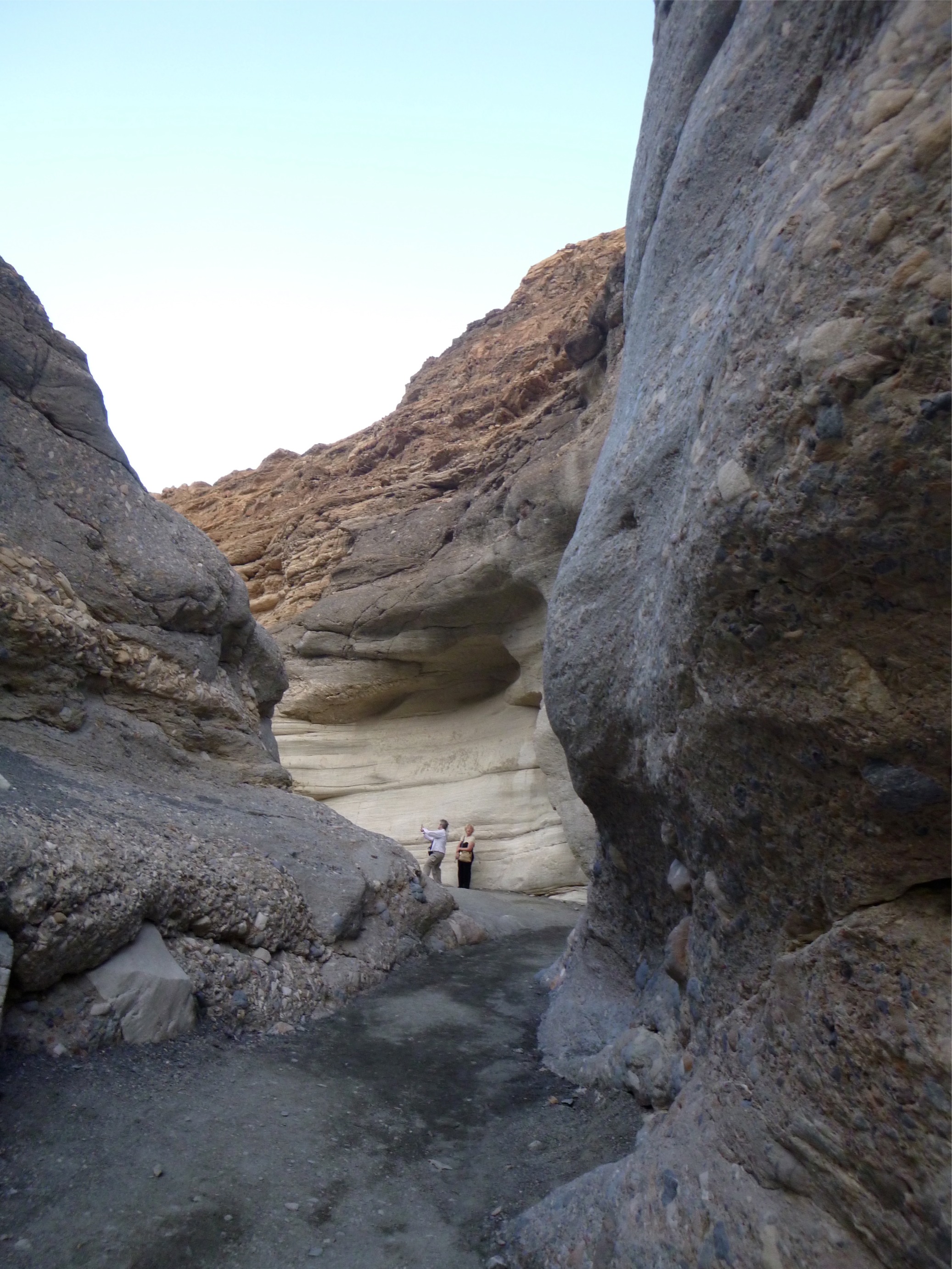
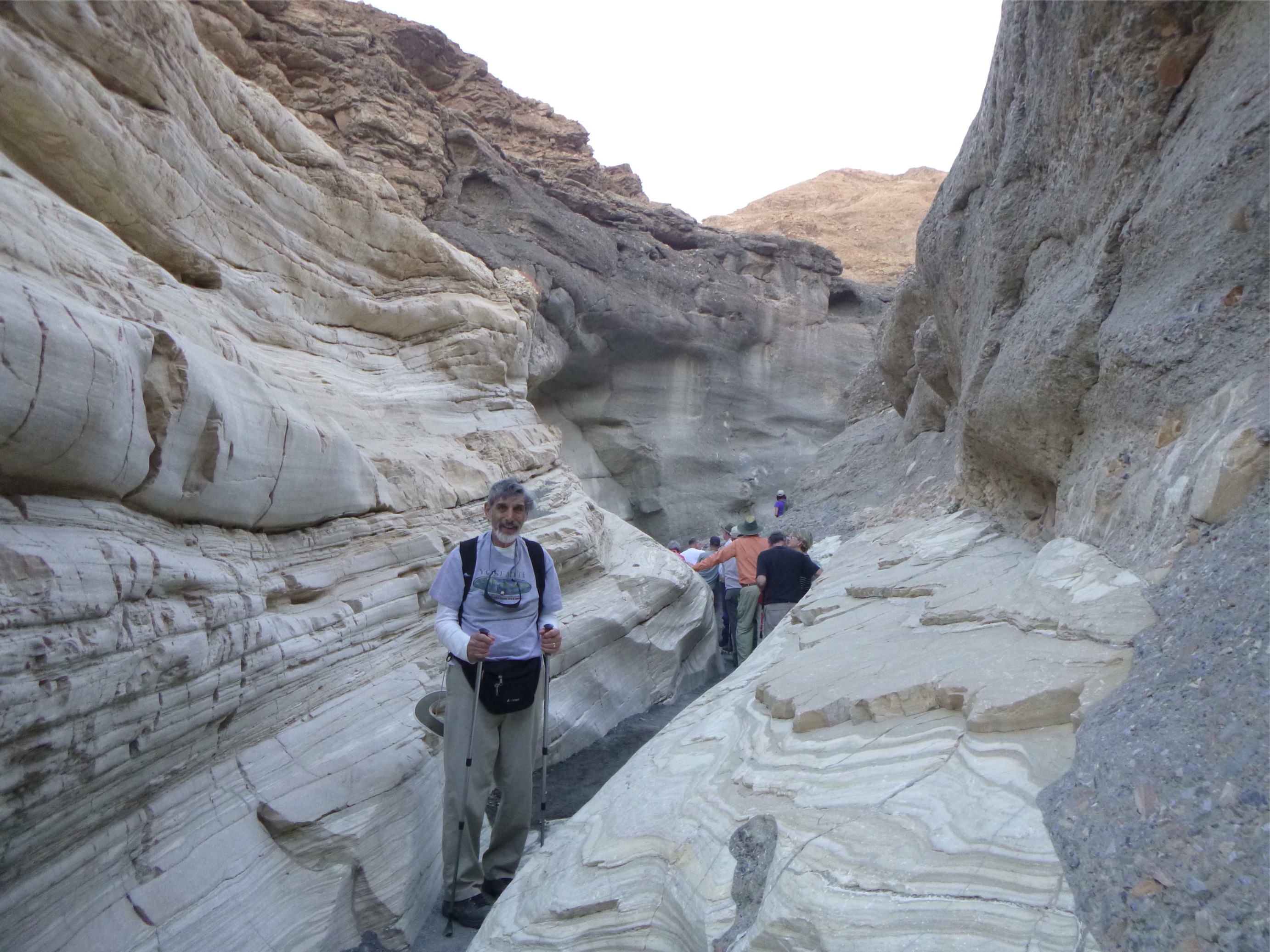
An even bigger surprise was the canyons which lined the valley. We only explored four of the hundreds in Death Valley National Park, and two of these, Natural Bridge and Mosaic, were just awesome.
The Natural Bridge Canyon trail was a relatively easy hike. About one mile into the canyon we came around a bend in the trail and could see the bridge looming off in the distance. Then of course, as we hiked to it we realized just how small we really are!!!
 |
 |
 |
 |
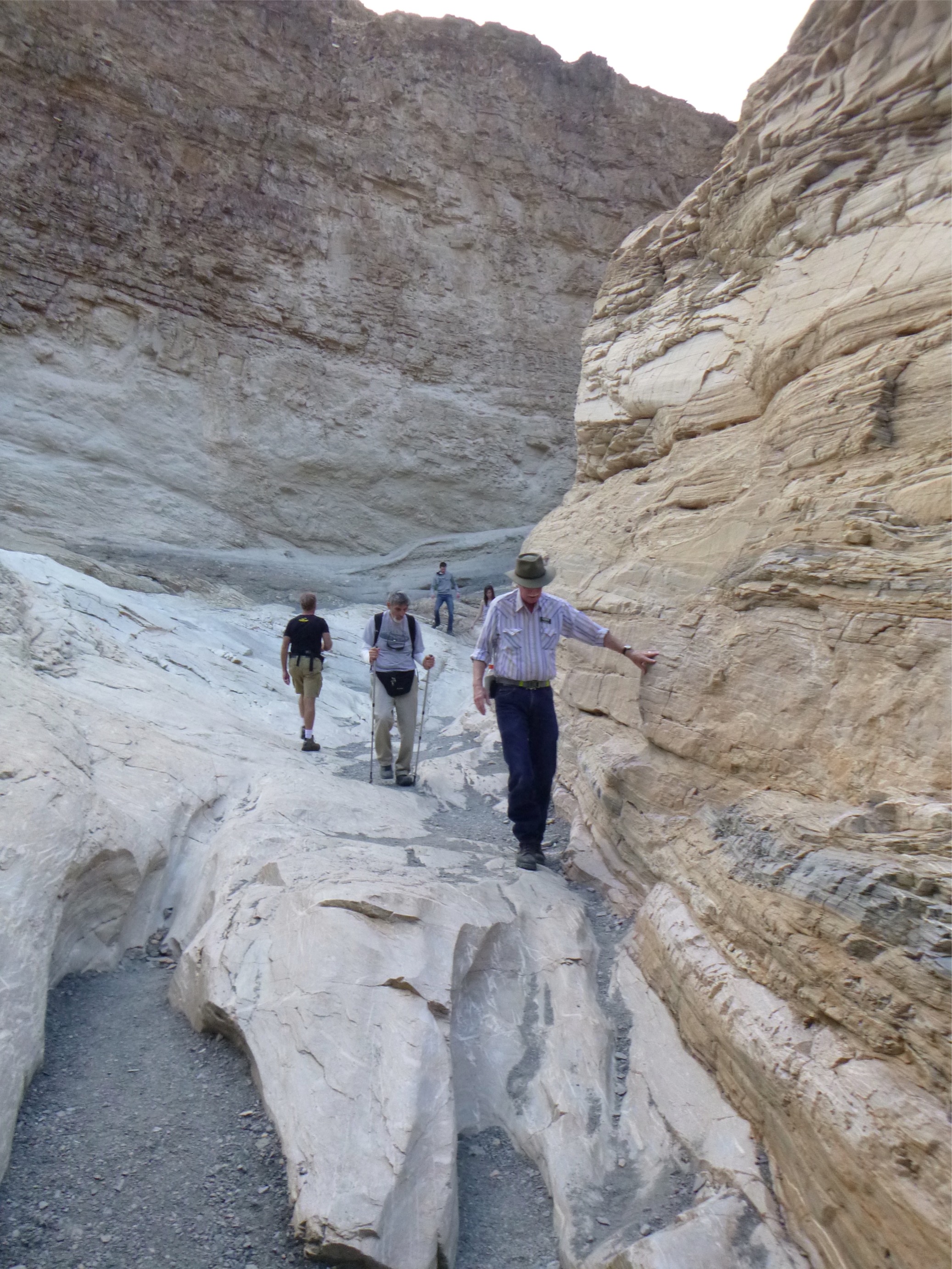
Mosaic Canyon earned its name from the terracotta marble that lined its sides: WOW!
 |
 |
 |
 |
Some Fun (and Interesting) Contrasts
At the National Park Visitor's Center we
watched a video that presented the Valley as a world of
contrasts: old and
young, high and
low, fast and slow, wet and dry, hot and hotter. And everywhere
we looked, these contrasts abound.
Old and Young
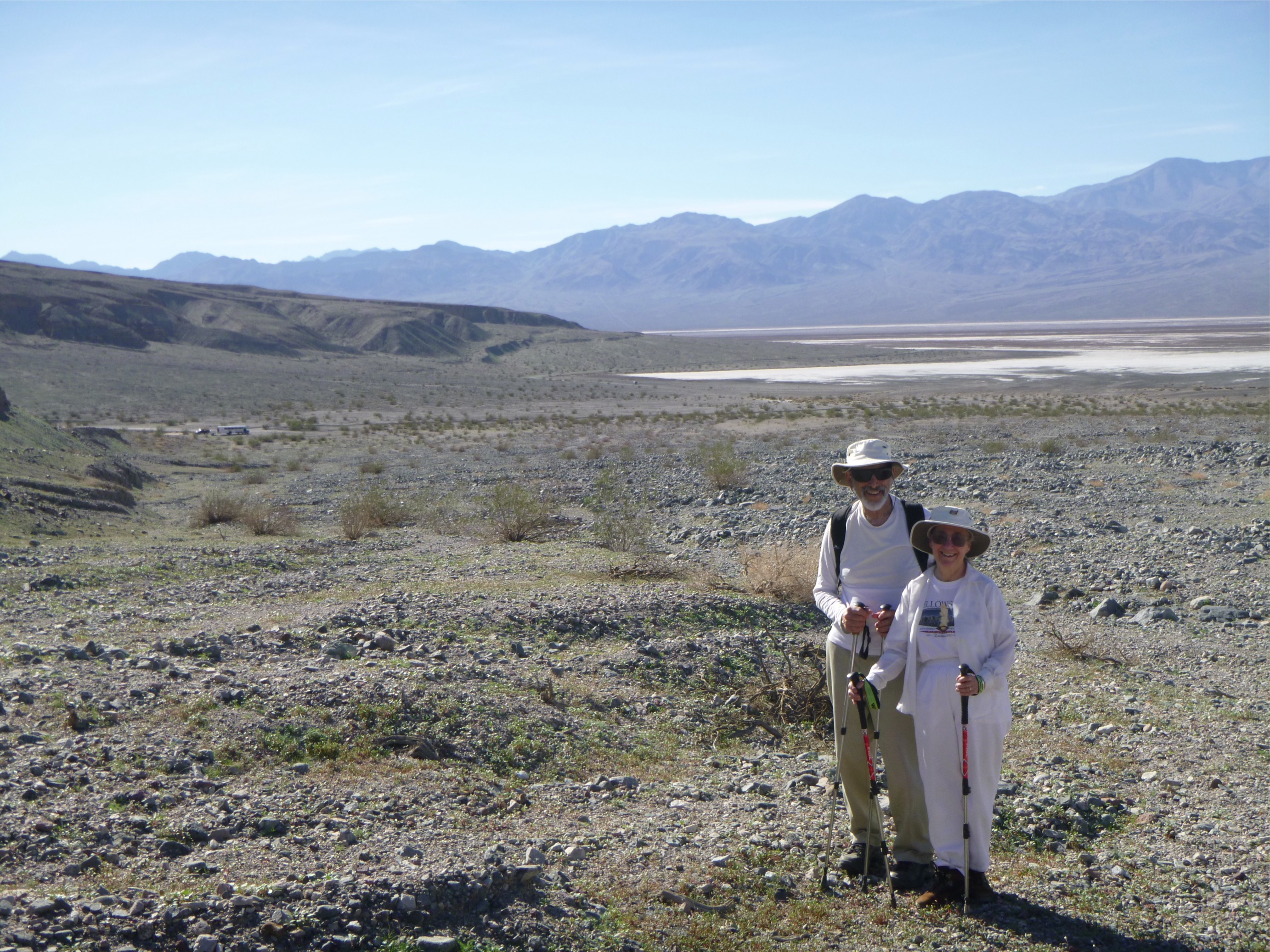
Our very first stop in Death Valley was at a spot called Willow Creek. Behind us we could see Turtle Rock, a rock that is 1.8 billion years old. Later we went to the Badwater Basin and the salt flats. We were told that every day new salt crystals are formed.
High and Low
 |
This picture was taken at Badwater
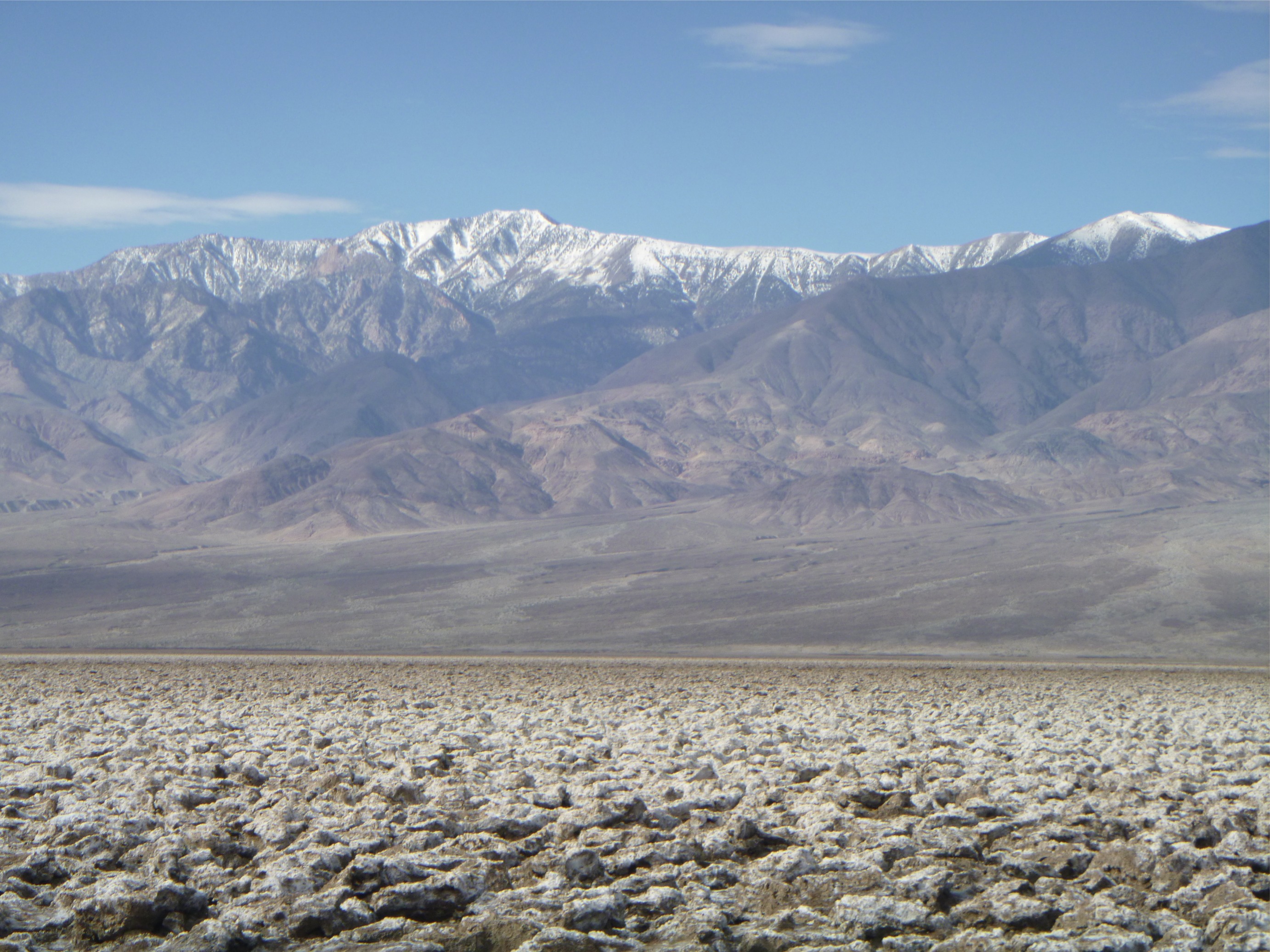
Basin, the lowest point in North America,
at 282 feet below sea level. Telescope Peak, the
highest point in Death Valley, looms behind at 11,043
feet above sea level. |
Wet and Dry
Death Valley averages less than 2 inches of
rain per year, making it the driest area in North America. In some years there
is no rain and in some years there are flash floods. In the midst of this
extremely dry desert there are springs which flow year round,
creating oasis's and a habitat for fish. Scotty's Castle was
built at one of these springs, as was the Furnace Creek Ranch
where we stayed. Furnace Creek has a hot spring, hence its name.
We swam each afternoon in the 82 degree natural hot spring
swimming pool. The water was changed every day and reused to
water the grass and trees.
Hot and Hotter
The hottest air temperature ever recorded in Death Valley was 134 degrees, making it the hottest place on Earth. Average winter temperatures are around 70 degrees while average summer temperatures are around 115 degrees.
Fast and Slow, Slow and Fast
This phrase refers to the geological forces shaping Death Valley (and actually the entire planet). Our geologist guides explained that the earth's tectonic plates push against each other moving very slowly at about the same rate as our fingernails grow. The pressure builds to a breaking point, taking perhaps hundreds or thousands of years. Then there is a sudden release of the energy that we feel as an earthquake, lasting a few seconds, resulting in the geological shape of our planet.
We saw other examples of slow and fast. It isn't the annual tiny rainfall that creates the canyons and alluvial fans of Death Valley, it's the 100 year floods. An alluvial fan is like a delta at the mouth of a river, the build up of the materials washed out of the canyon. Because all the canyons in Death Valley flow into a relatively flat valley without any river to wash the debris away, the build up creates a fan like layer of dirt and rock.
Another example of slow and fast is the Ubehebe Crater. A deep crack in the surface (called a fissure) allowed magma to creep toward the surface. The magma hit a pocket of water that turned to steam. In a matter of seconds, the tremendous pressure of the steam blew out a hole 600 feet deep and one-half mile across.
Slow and fast, fast and slow. Fantastic idea when you think about them geologically
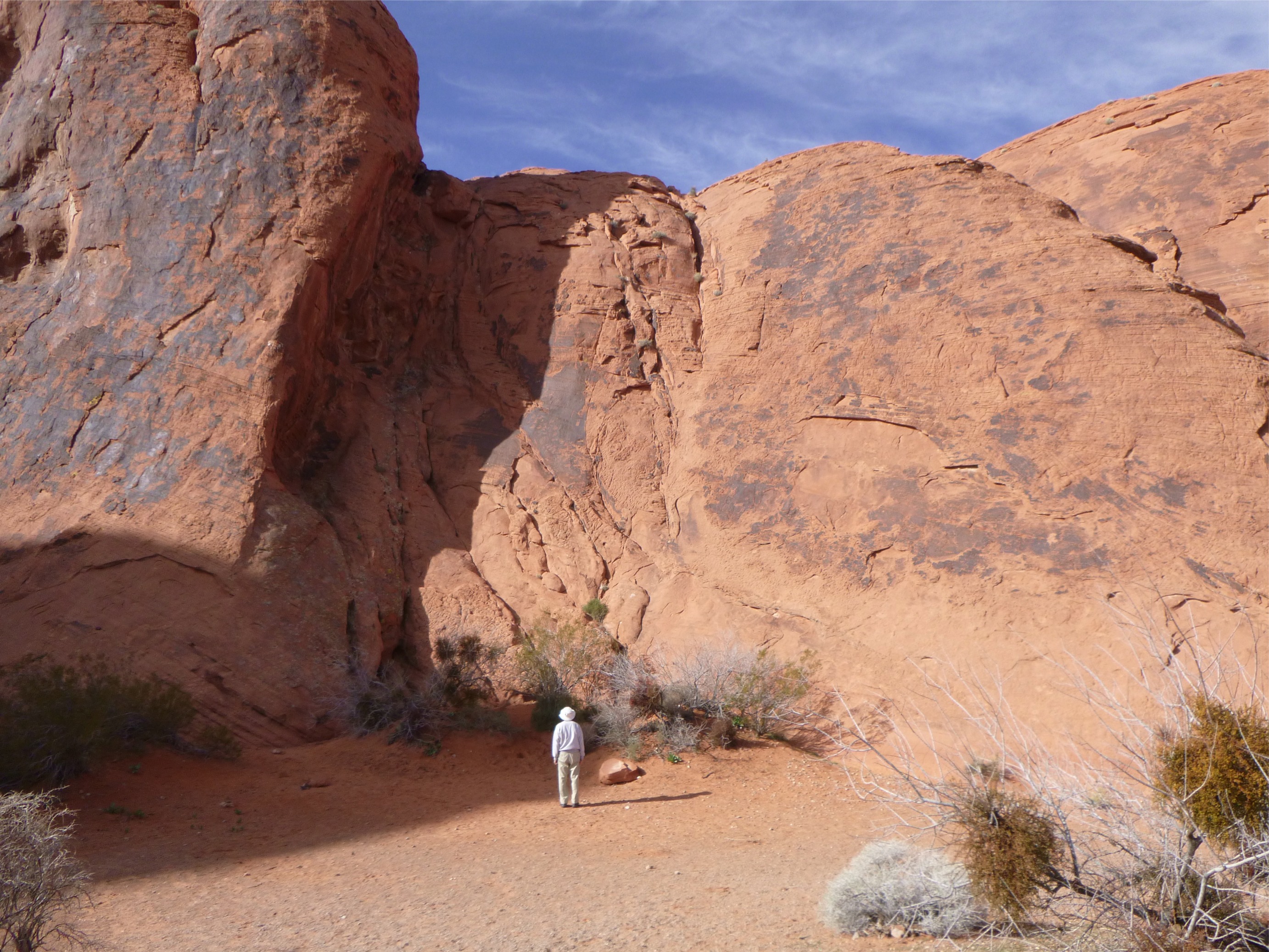
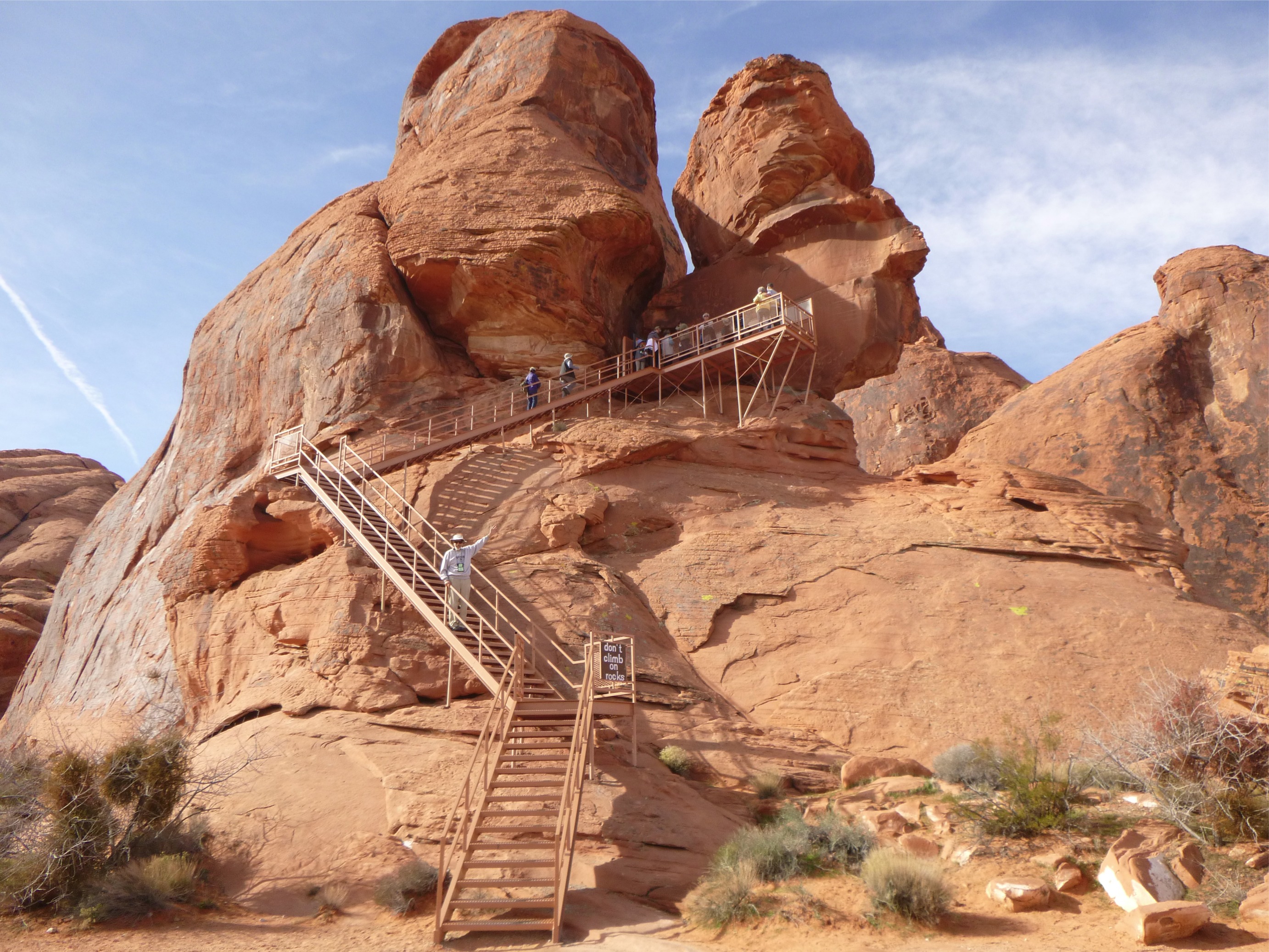
Valley of Fire and Native's Petroglyphs
Our first excursion was to the Valley of Fire, a Nevada State Park an hour drive north of Las Vegas. It derives its name from red sandstone formations formed 150 million years ago. We spent one day hiking a couple of very interesting trails and viewing the petroglyphs created some three to five thousand years ago by the native people that lived in the area.
 |
 |
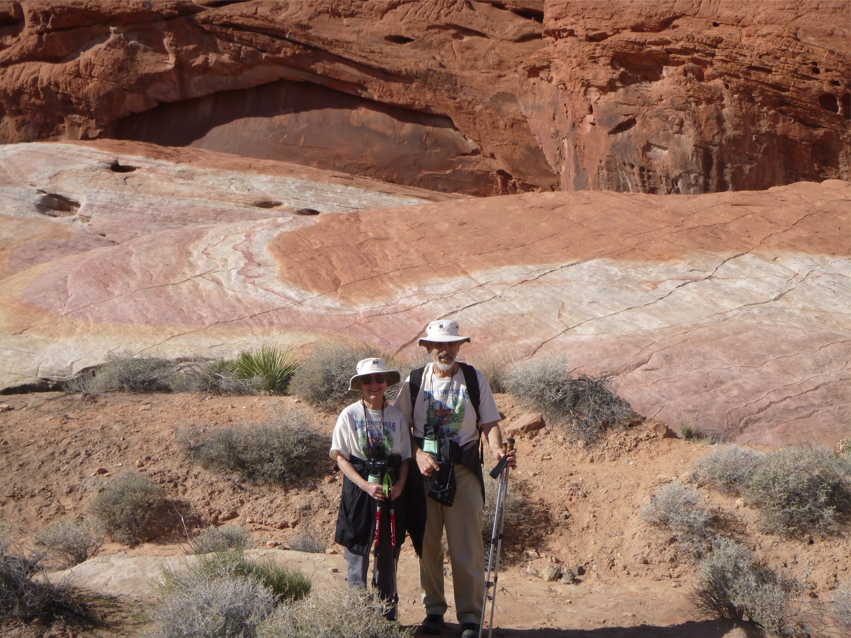 |
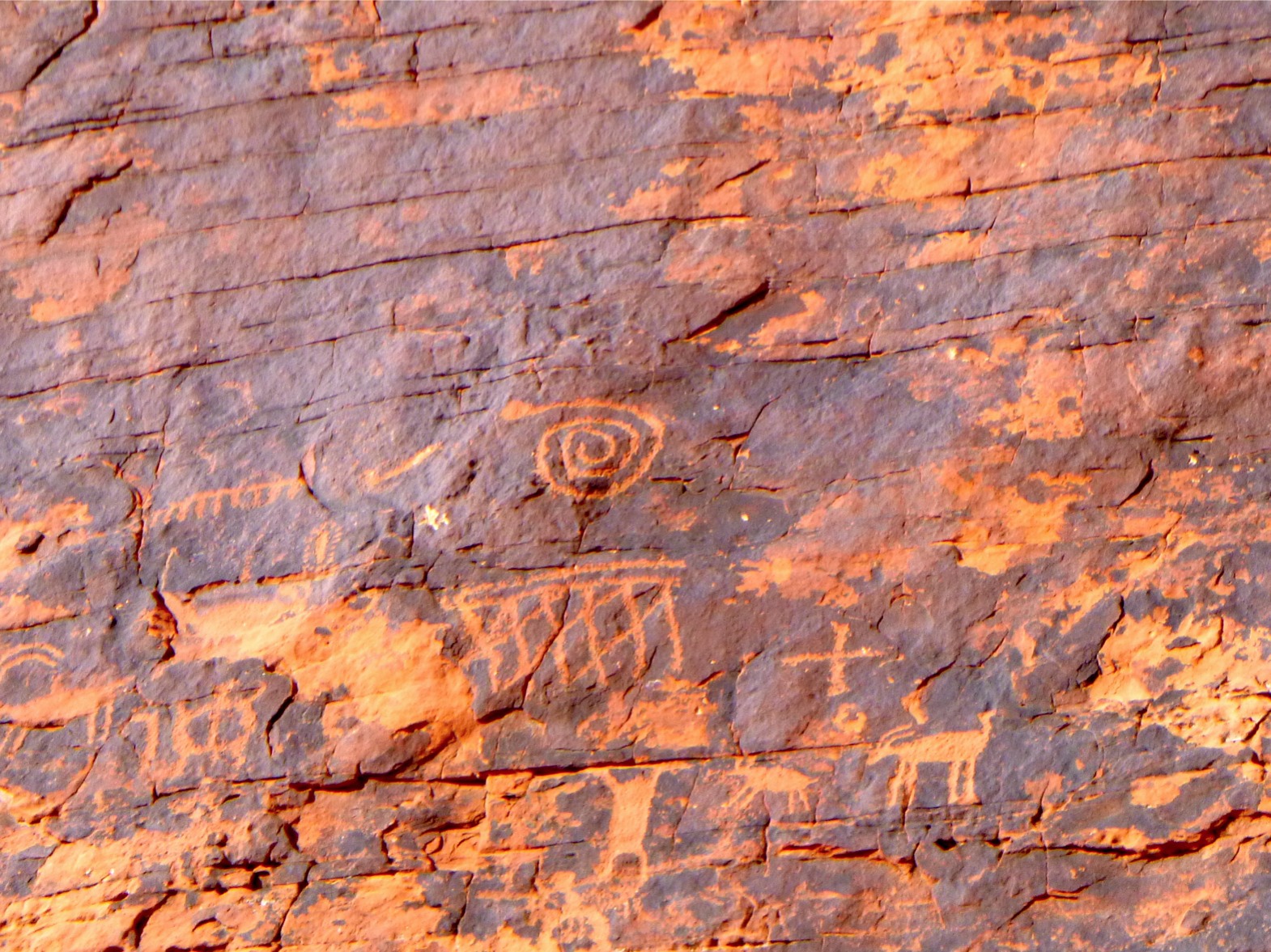
Photo journalist: Lois Frand
Writer: Jason Frand
Editor: Lois Frand
You can reach us via email at Jason or Lois February 17, 2015